...a part of the International Weather Satellite Images.
This section has three types of satellite images. The first is images of the whole (or half) globe formed from all the infrared satellite images around the globe. The second type is images from sites that cover the whole world, but may or may not have one image covering the whole world. Most of these are commercial sites, although CIMSS, which has images of the tropical oceans, is not. The third type is images from polar orbiting satellites, some of which are cloud images and some of which are images of other data obtained from polar orbiting satellites.
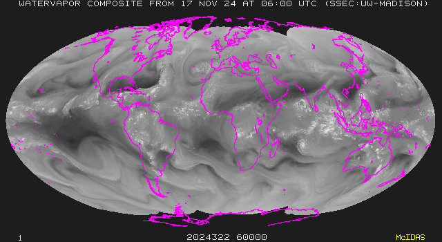
The Composite World image is a small image produced every three hours that shows the entire world. It is not useful for seeing specific systems, but it is useful to get an overview of what storms are going on in the world.
The Global Montage shows clouds in areas of cold clouds (from infrared imagery), land surface temperatures, and sea surface temperatures. Because of the fact that there are three things visible in this image, it becomes difficult to get a good picture of one, because each (temperatures, clouds) is partially obscured for the necessity of showing the other.
The east and west Tropical Mosaics from the CIMSS Tropical Page are higher resolution images than the other composites, but do not cover the areas up to the poles. They are available every three hours and movies are available that cover the last 60 hours.
These CIMSS images are good, detailed views of the tropics (not actually composites from multiple satellites), many of which have wind observations on top of the satellite images.
These images are tropical composites similar to those from CIMSS, but they also have zoomed in current images of all active tropical cyclones, with an archive of some of these zooms.
The Global Hydrology and Climate Center, part of NASA's Marshall Space Flight Center, provides an interesting interface to global satellite imagery.
The Washington images are rather standard composite images.
The weather channel images cover many areas of the world using projections that often stretch the available data. They don't have global composites (anymore), though.
The Intellicast images are colorized, enhanced infrared images, and very presentable, but rather low resolution. The Full Earth Image is especially bad because it is a mercator projection, giving much more space to areas near the poles. Some of them are not updated often at all.
CNN Provides a set of low quality satellite images from AccuWeather. They do a bad job of showing cloud color only in some areas.
EarthWatch provides a few satellite images.
The NASA/GSFC site A Global View From Space provides the following interface to worldwide satellite images. The images are small, and they only show global views. It allows the user to rotate the Earth and look at different sides.
The Earth and Moon Viewer shows currently lit regions of the earth against a background of topographic images, false color images, or satellite imagery.
This composite infrared view of Antarctica is produced at SSEC. It is about as good a composite as can be produced from the data available, and is updated every three hours.
See the Section on Polar Orbiting Satellite Information for technical information about these images.
The NOAA Satellite Active Archive provides NOAA Polar orbiter imagery going back for years. The images can be retrieved through a search mechanism, which is sometimes a little difficult to use, and can be viewed or ordered. Visible imagery is often not available, and it is difficult to tell when it is. The search engine occiasionally returns incorrect results. The images are distorted on the sides parallel to the path of the satellite, due to the mechanism of the polar orbiter satellites and the fact that they travel much closer to the earth than do the geostationaries. The lack of map lines often makes use of these images difficult for many purposes.
The DMSP search interface allows searching of F10 through F13 polar imagery as well. One must fill out a form and then click on a map for the location of the images. The nighttime visible imagery shows city lights quite well. It has the advantage of map lines.
I maintain a list of Sea Surface Temperature (SST) images on another page.