...a part of the International Weather Satellite Images.
[Français]
Satellite images of Europe are widely available because of the large presence of European sites on the WWW, but good images are restricted because the transmission of high resolution images from the METEOSAT satellite is encrypted.
All images (except the polar orbiter images) on this page are taken from METEOSAT-7. The METEOSAT satellites are operated by EUMETSAT (Text version - English) in cooperation with the European Space Agency. METEOSAT-7 is now located above the intersection of the Prime Meridian and the Equator. METEOSAT-7 replaced METEOSAT-6 on 1998 June 3. METEOSAT-6 replaced METEOSAT-5 on 1997 February 13. METEOSAT-6, which had some calibration problems, is now the backup satellite, at about 9°W. METEOSAT-5 is over the Indian Ocean at 64°E, and is taking images there for the INDOEX project.
ESA has some Information on METEOSAT missions that describes the history of the program and many aspects of ESA's involvement in the program (launch, etc.). They also have a description of the Meteosat Second Generation program and satellites. EUMETSAT maintains an online magazine, IMAGE (The May 1998 issue had good information on satellite programs).
The Meteosat Dissemination Schedule is useful to those interested in receiving images. EUMETSAT also has information on meteorological (derived) products. On another note, EUMETSAT's EUMETSAT Meteorological Archive and Retrieval Facility's MARF Online Interface may soon provide browse images back to 1979.
See GEO-NEWS and SatNews for more information about the METEOSAT program.
The Strasbourg site has images similar to the standard METEOSAT images from Nottingham and ESO. The archive, however, is phenomenal, as it runs back to 1996 June 8. It contains infrared images every six hours and visible images every day.
This site has form interfaces to images (JPEG) and animations (MPEG). The images are produced every hour or every three hours, and are archived for 24 hours, while the animations are produced daily and archived for 28 days. The images themselves are shrunken versions of the METEOSAT WEFAX images.
Does this site exist anymore? I couldn't get through on 1999-06-27...
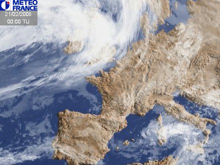
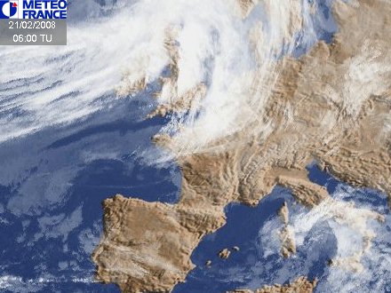
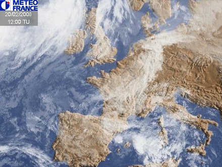
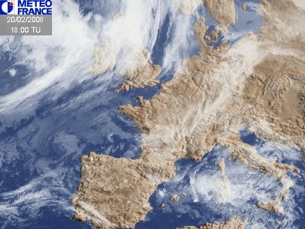
These are the new Météo-France images. They are small, and not as good as the old ones.
Brazil's Divisão de Satélites Ambientais provides a number of satellite images of the whole earth and of Brazil. The archives vary in length from a few weeks to a few months. There are also GOES Images at the site.
The ESO Images are shrunken versions of the METEOSAT WEFAX images. The only advantage over Nottingham's is that they offer animations and mosaics.
The Naval European Meteorology and Oceanography Center provides these satellite images.
These sites have very small sets of images, and thus, I think, don't merit their own sections.
See the section on global polar archives for many other great sites.
The weather channel images are probably the best of the composite images from major weather companies. The small images are useful only for overview, the large images are of reasonable size.
The Intellicast images are colorized, enhanced infrared images, and very presentable, but rather low resolution. The Full Earth Image is especially bad because it is a mercator projection, giving much more space to areas near the poles. Some of them are not updated often at all.
Intellicast recently changed all their links, and not all the redirects work. That is bad business. I'll try to figure out what they did and fix these links sometime...
CNN Provides a set of low quality satellite images from AccuWeather. They do a bad job of showing cloud color only in some areas.