North (and South) American Satellite Imagery (Page 1c)
...a part of the International Weather Satellite Images.
to Previous Page of American Images
The NASA/Goddard Space Flight Center Images are mainly the top
resolution images that come in on the GOES feed. They mainly
cover small areas, and the images had map lines, which have now
been replaced by external map files, so they are generally good
images with the problem that it is hard to see what is where.
They are often the best images for getting good images of small
systems such as hurricanes. The problem is, the images are in
TIFF format, which makes them difficult to view. A good Windows viewer
is Paint Shop Pro 3.11,
or the slightly smaller Version 3.0. There is also
Version 4.14
for Windows NT/95, which I have not yet tried.
Sounder images are also available from GSFC (in the
sounder subdirectory for each satellite). I am trying to find
more information about the different sounder channels. The
Archive runs back a few days. Channel Information is below.
These images are from the interactive viewer at
NBC4's weather site. They seem to be based on the images
from NASA/GSFC.
- Full Earth, zoomed on:
Lower Left,
Lower Right,
Upper Right,
Upper Left,
Center
- New England, zoomed on:
Lower Left,
Lower Right,
Upper Right,
Upper Left,
Center
- Chesapeake, zoomed on:
Lower Left,
Lower Right,
Upper Right,
Upper Left,
Center
- Florida, zoomed on:
Lower Left,
Lower Right,
Upper Right,
Upper Left,
Center
- Great Lakes, zoomed on:
Lower Left,
Lower Right,
Upper Right,
Upper Left,
Center
- Iowa, zoomed on:
Lower Left,
Lower Right,
Upper Right,
Upper Left,
Center
- Gulf Coast, zoomed on:
Lower Left,
Lower Right,
Upper Right,
Upper Left,
Center
- Oklahoma, zoomed on:
Lower Left,
Lower Right,
Upper Right,
Upper Left,
Center
- Colorado, zoomed on:
Lower Left,
Lower Right,
Upper Right,
Upper Left,
Center
- NorthWest, zoomed on:
Lower Left,
Lower Right,
Upper Right,
Upper Left,
Center
- California, zoomed on:
Lower Left,
Lower Right,
Upper Right,
Upper Left,
Center
- Baja California, zoomed on:
Lower Left,
Lower Right,
Upper Right,
Upper Left,
Center
- Mexico South, zoomed on:
Lower Left,
Lower Right,
Upper Right,
Upper Left,
Center
- Nicaragua, zoomed on:
Lower Left,
Lower Right,
Upper Right,
Upper Left,
Center
- Hispañola, zoomed on:
Lower Left,
Lower Right,
Upper Right,
Upper Left,
Center
- Aruba, zoomed on:
Lower Left,
Lower Right,
Upper Right,
Upper Left,
Center
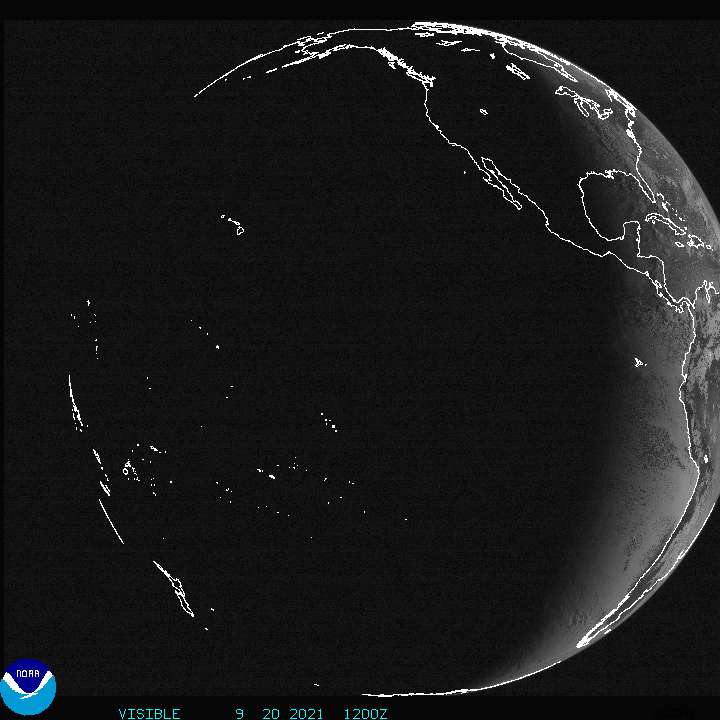
- GOES-8 (EAST) Full Disk:
Visible,
Infrared
- GOES-10 (WEST) Full Disk:
Visible,
Infrared
- Northern Hemisphere GOES Composite:
Visible,
Infrared,
Water Vapor
- East CONUS (Continental US)
- West CONUS (Continental US)
- Puerto Rico:
Infrared,
Visible,
Water Vapor
- Alaska:
Infrared,
Visible,
Water Vapor
- Hawaii
Infrared,
Visible,
Water Vapor
- Storm Floater Sector:
Visible,
IR Channel 2,
IR Channel 3,
IR Channel 4,
IR Channel 5
- Hurricane Sector:
Visible,
Infrared,
Water Vapor
- Coastwatch Images - Eastern Coasts
- GOES-8 Archive
- GOES-9 Archive
- GOES-10 Archive
These images show rather good views of North America and the world.
The full disk images are updated every three hours, and the others are
updated every hour. The MPEG animations cover the last 48 images, and are
very good for seeing the general motions of the atmosphere, especially the
global (full disk) animation, since they move very fast, but not very good
at specific weather features.
- GOES-8 (EAST)
- Full Disk
- Eastern Canada (includes most of Eastern USA)
- Eastern North America
- GOES-9
- Full Disk
- Western Canada (includes most of Eastern USA)
- Western North America
to Next Page of American Images

(Back to American Images,
International Weather Satellite Images)
LDB,
dbaron@dbaron.org